

A Complete Guide to Visiting Grand Teton National Park
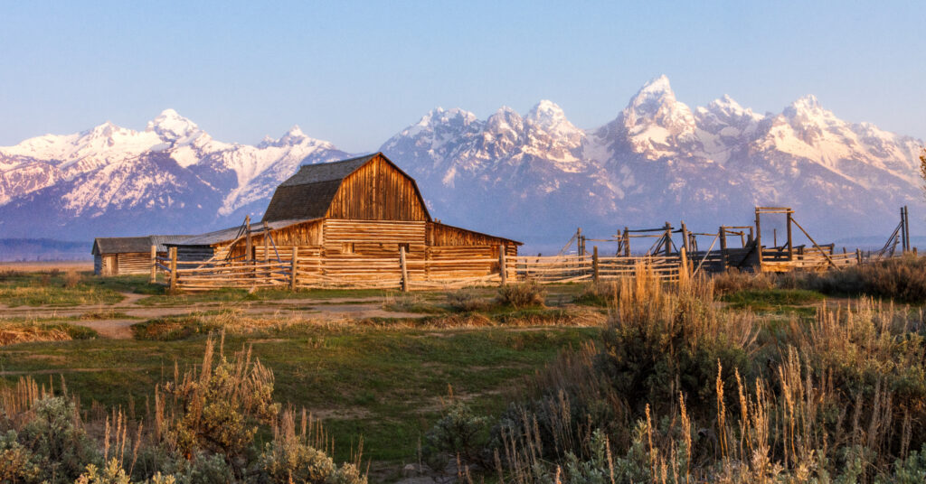
Grand Teton National Park is one of those places that almost does not look real until you see it for yourself. That’s where this Grand Teton National Park visitor guide comes in! Jagged mountain peaks rise almost straight from the valley floor. Glacial lakes reflect the mountains in the early morning. Moose wander through willow-lined wetlands. Hiking trails disappear into deep alpine canyons. Historic barns sit beneath one of the most recognizable mountain skylines in America. And unlike many mountain ranges, the Tetons have almost no foothills blocking the view. You can be driving across the flat sagebrush landscape of Jackson Hole and suddenly find yourself staring directly at a wall of 13,000-foot peaks. Grand Teton is also one of the easiest national parks to combine with Yellowstone—but it absolutely deserves its own dedicated time. This free Grand Teton National Park visitor guide covers the basics you need to start planning, including: The best time to visit The main areas of Grand Teton How to get there and get around The top things to do A few of the best hikes Where to stay Where to eat How much time you need Things to know before you go What to pack The best photo spots Family travel tips For the full planning breakdown, our Premium Grand Teton National Park Ultimate Guide includes the exact 3-day itinerary, nine complete hike and scenic-stop profiles, regional planning strategy, Jenny Lake logistics, wildlife-viewing advice, detailed lodging information, photography recommendations, 2026 trail and access updates, and everything you need to confidently organize your trip. 👉 Grab the complete Grand Teton National Park Ultimate Guide in our shop and take the stress out of planning your adventure. About Grand Teton National Park Grand Teton National Park protects one of the most dramatic mountain landscapes in America. The park is famous for: The Teton Range Jenny Lake Jackson Lake Cascade Canyon Mormon Row Schwabacher Landing Oxbow Bend Alpine lakes Moose, elk, bears, and other wildlife Some of the best hiking in the Rocky Mountains The thing that makes the Tetons look so dramatic is the way they rise almost directly from the valley floor. There is no long line of smaller foothills hiding the higher peaks. Instead, the mountains suddenly climb thousands of feet above Jackson Hole. The geology behind that scenery is equally fascinating. The Teton Range is relatively young, but much of the exposed rock is billions of years old. Glaciers also played a huge role in creating the landscape visitors see today. They carved: Deep canyons U-shaped valleys Alpine basins And left behind many of the lakes now found along the base of the mountains, including: Jenny Lake String Lake Leigh Lake Taggart Lake Bradley Lake Phelps Lake Grand Teton is also much easier to understand geographically than Yellowstone, but that does not mean you should simply make a list of attractions and drive back and forth across the park. A little planning still makes a huge difference. The Main Areas of Grand Teton National Park You do not need to memorize every road and lake before your trip, but understanding the main areas will make planning much easier. Jenny Lake For many first-time visitors, Jenny Lake is the heart of Grand Teton National Park. This area is known for: The Jenny Lake shuttle boat Hidden Falls Inspiration Point Cascade Canyon Lakeshore trails Mountain views It is also the busiest area of the park. The combination of easy scenery, popular hiking, boat access, and limited parking means the area can feel very different early in the morning than it does at midday. One of the most important things to understand before visiting Grand Teton is how you want to experience Jenny Lake. You can: Take the shuttle boat Hike around part of the lake Walk the full lakeshore Continue farther into the mountains The premium guide explains the different options and helps you decide which one makes sense for your time and hiking ability. Cascade Canyon Cascade Canyon begins beyond the popular Jenny Lake area and leads deep into the Teton Range. This is where Grand Teton starts to feel very different from a simple sightseeing park. The scenery includes: Towering canyon walls Mountain streams Wildlife habitat Alpine landscapes Longer hiking opportunities Many visitors only explore the beginning of the canyon. Others continue much farther into the high country. How far you should go depends heavily on your fitness, available time, weather, and hiking goals. String Lake and Leigh Lake String Lake is one of the best family-friendly areas in the park. The scenery is classic Grand Teton: Clear water Forest Mountain views Easy lake access The water is also relatively shallow, making this one of the more popular places for families to swim or spend part of a summer afternoon. Nearby Leigh Lake offers a quieter extension for visitors who want to keep walking. This area can be a great alternative when Jenny Lake feels overwhelmed. Taggart Lake and Bradley Lake Taggart Lake and Bradley Lake offer another classic Grand Teton experience. You will find: Mountain views Glacial lakes Forest trails Wildflower meadows These lakes are popular, but they often feel much less chaotic than Jenny Lake. They are especially worth considering for visitors who want a real hike without committing to a full-day alpine adventure. Moose and the Southern Park The Moose area is one of the main gateways into Grand Teton. Nearby attractions and routes provide access to: Teton Park Road Southern hiking areas Wildlife habitat Scenic overlooks The Moose-Wilson Road The southern part of the park can feel quieter than the Jenny Lake corridor. This area is also an important place to understand if you are planning around Phelps Lake or other southern hikes. Jackson Lake and the Northern Park The northern part of Grand Teton feels more open. Jackson Lake provides: Wide mountain views Boating Scenic pullouts Lodging Easier access toward Yellowstone This area works especially well for travelers combining both national parks. It can also be a
Moab Stargazing Guide 2026: What to Know Before You Go
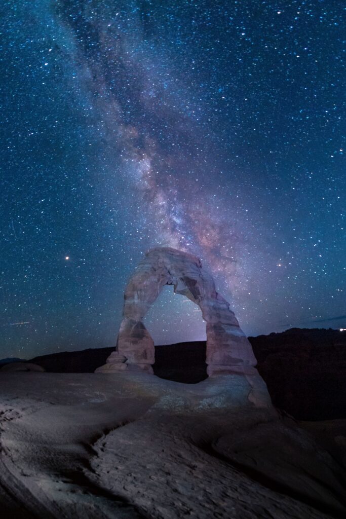
Moab is famous for red rock arches, towering sandstone cliffs, dramatic canyons, and some of the most unforgettable landscapes in Utah. But when the sun goes down, an entirely different side of Moab comes to life. Thousands of stars appear overhead. The Milky Way stretches across the desert sky. Red rock arches and sandstone towers become silhouettes against the stars. And in some of the darkest places in the region, the night sky can look almost nothing like what most of us see from home. Moab sits at the center of one of the greatest dark-sky regions in the world, surrounded by internationally recognized places including Arches National Park, Canyonlands National Park, Dead Horse Point State Park, and other remote public lands. This free Moab stargazing guide will help you get started, including: The best time to see the Milky Way in Moab A few of our favorite stargazing locations Where to go with kids What to know about moon phases Basic astrophotography tips What to pack Where to stay How to combine stargazing with an Arches or Canyonlands trip But this is just the starting point. Our Premium 21-Page Moab Astro Tourism Guide goes much deeper with all 11 of our recommended stargazing and astrophotography locations, exact access details, a complete 3-day itinerary, camera settings, gear recommendations, guided tour information, dark-sky lodging, night-access rules, and everything you need to confidently plan your own Moab night-sky adventure. 👉 Grab the complete Moab Astro Tourism Guide in our shop and take the guesswork out of planning your trip. Why Is Moab So Good for Stargazing? Moab is one of the best places in the United States to experience a truly dark night sky. Several things come together here: Very little light pollution outside town High desert elevation Dry air Huge areas of undeveloped public land Multiple protected dark-sky destinations Years of local efforts to reduce unnecessary nighttime lighting Moab itself is now an officially certified International Dark Sky Community, joining a growing number of Utah communities committed to protecting the night sky. Within easy driving distance of downtown Moab, you can also reach: Arches National Park Canyonlands National Park Dead Horse Point State Park Castle Valley Fisher Towers Potash Road The La Sal Mountains That means you can spend your day hiking beneath towering arches and your night watching the Milky Way above them. On a clear, moonless night away from town, the difference can be incredible. You may see: Thousands of stars The Milky Way stretching overhead Star clusters Meteor showers Planets Jupiter’s largest moons with binoculars Even more detail through a telescope For many families, this becomes one of the most memorable parts of a Moab trip. Best Time for Stargazing in Moab You can stargaze in Moab year-round, but what you see changes with the seasons. Spring: March–May Spring is an excellent time to visit Moab. The daytime temperatures are usually more comfortable than summer, wildflowers may be blooming, and the Milky Way’s bright galactic core begins becoming visible before sunrise. Spring works well for travelers who don’t mind getting up very early for a pre-dawn photography session. Summer: June–August Summer offers some of the longest opportunities to see the Milky Way’s bright core. The nights are warmer, which can make sitting outside under the stars more comfortable. The tradeoffs are: Hot daytime temperatures Larger crowds Summer storms Late sunsets This can still be an incredible season for night photography. Fall: September–November Fall is our favorite overall season for Moab stargazing. September and early October can offer an ideal combination of: Comfortable temperatures Thinner crowds Clearer air Early-evening Milky Way opportunities For many visitors, this is the easiest time to combine hiking, photography, and stargazing without dealing with the worst heat of summer. Winter: December–February The bright Milky Way core is below the horizon at night during winter, but that does not mean winter is a bad time for stargazing. Winter can offer: Very dark skies Clear, dry air Far fewer crowds Beautiful winter constellations Meteor showers Deep-sky viewing It is also much colder than many first-time visitors expect, so dress accordingly. The Most Important Thing to Check: The Moon Before you book a stargazing trip, check the moon phase. For the darkest sky and best view of faint stars and the Milky Way, plan around the new moon. A good rule is to aim for the few days before or after a new moon. A bright moon can wash out: Fainter stars The Milky Way Deep-sky details But a full moon is not necessarily a wasted night. Moonlight can create a completely different kind of experience, especially for: Moonlit desert walks Photographing red rock foregrounds Viewing canyon landscapes after dark Families who don’t need a completely black sky The best moon phase depends on what you want to experience. Our Premium Moab Astro Tourism Guide gives you the deeper planning strategy, including how to match your trip timing to the kind of night-sky experience you want. Best Places to Stargaze Near Moab Moab has far more night-sky locations than most first-time visitors realize. Here are a few of the easiest and most iconic places to start. Our complete premium guide includes 11 detailed locations, with access information, driving distances, difficulty levels, night-use considerations, and our insider tips for each one. Canyonlands National Park Canyonlands is one of the darkest and most spectacular places near Moab. The Island in the Sky District offers huge open horizons and dramatic canyon views, making it incredible for: Naked-eye stargazing Milky Way photography Wide-angle night landscapes Meteor showers Popular areas include the Mesa Arch and Grand View Point region. After dark, the busy daytime crowds can disappear, leaving behind a completely different experience. A few things to remember: Bring offline maps. Watch your footing around canyon rims. Bring multiple light sources. Keep white light to a minimum around other stargazers and photographers. For our exact Canyonlands night locations and planning notes, check
A Complete Guide to Visiting Great Smoky Mountains National Park
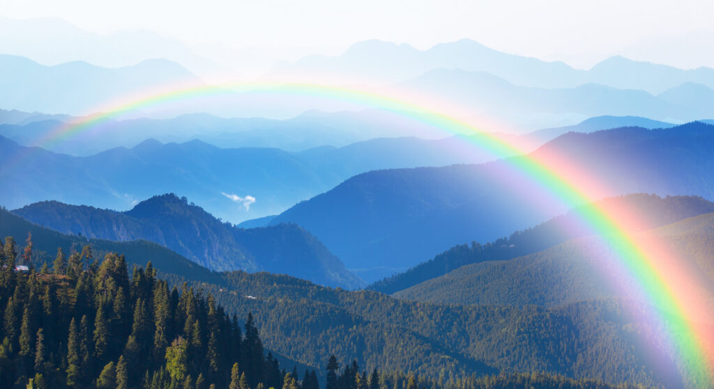
Great Smoky Mountains National Park is unlike any other national park in the country. There are no massive red rock cliffs, desert arches, or geysers exploding from the ground. Instead, the Smokies are filled with ancient mountains, endless forest, misty blue ridgelines, historic cabins, waterfalls, wildlife, and some of the most beautiful scenic roads in the eastern United States. Straddling the Tennessee–North Carolina border, Great Smoky Mountains is also the most visited national park in America. And while it does not charge an entrance fee, that does not mean there is nothing to plan. The park is huge. Cell service is limited. Popular roads can become extremely congested. Trailhead parking fills early. Weather changes quickly. And because the park has several different gateway towns and regions, where you stay can completely change your trip. This free Great Smoky Mountains National Park visitor guide covers the basics you need to start planning, including: The best time to visit How the parking tag system works The main areas of the park How to get there and get around A few of the best things to do Some of the most popular hikes How much time you need Where to stay Wildlife and family tips What to pack For the full planning breakdown, our Premium Great Smoky Mountains National Park Ultimate Guide includes a complete 3-day itinerary, nine detailed trail and experience profiles, road and crowd strategy, synchronous firefly information, hiking logistics, photography tips, lodging recommendations, gateway town comparisons, safety information, and everything you need to confidently organize your trip. 👉 Grab the complete Great Smoky Mountains National Park Ultimate Guide in our shop and take the stress out of planning your adventure. About Great Smoky Mountains National Park Great Smoky Mountains National Park stretches across the Tennessee–North Carolina border in the southern Appalachian Mountains. The park is known for: Layered blue mountain views Waterfalls Dense forest Historic homesteads Scenic drives Black bears Elk Wildflowers Fall colors Synchronous fireflies The Smokies are part of one of the oldest mountain ranges on Earth. Millions of years of erosion have softened the landscape into the rounded, forest-covered peaks that make the park look so different from younger mountain ranges in the western United States. The famous blue haze is also real. The dense forest releases natural organic compounds that scatter blue light, creating the smoky appearance that gives the mountains their name. Great Smoky Mountains is also one of the most biodiverse places in the National Park System, with thousands of documented species and new species still being identified. It is especially famous for salamanders, earning the region the nickname “Salamander Capital of the World.” The Main Areas of Great Smoky Mountains National Park The Smokies do not have one central scenic loop that connects everything. Instead, different roads and regions offer very different experiences. Understanding those areas before your trip will save you a lot of unnecessary driving. Cades Cove Cades Cove is one of the most famous areas in the park. The valley is known for: Wildlife Historic cabins Churches Open meadows Mountain views Scenic driving The one-way loop is beautiful—but it can also be one of the slowest drives in the park when traffic or wildlife stops vehicles. Early morning is usually the best time to visit. Newfound Gap Road Newfound Gap Road crosses the park between Gatlinburg, Tennessee, and Cherokee, North Carolina. Along the way, you will find: Mountain overlooks Trailheads The Tennessee–North Carolina state line Access toward Kuwohi Dramatic elevation changes This is one of the best roads for getting a broad feel for the Smokies. Kuwohi Formerly known as Clingmans Dome, Kuwohi is the highest point in Great Smoky Mountains National Park. A short but steep paved trail leads to the famous observation tower. On a clear day, the views can stretch across layer after layer of mountain ridges. On a hazy day, visibility may be much more limited. That unpredictability is part of the Smokies experience. Roaring Fork The Roaring Fork area sits near Gatlinburg and offers: A scenic motor nature trail Historic cabins Forest scenery Waterfalls Popular hiking access This area works especially well for travelers staying in Gatlinburg. Cataloochee Valley Cataloochee is one of the park’s more remote regions. It is best known for the elk that were reintroduced to the Smokies. This area requires more effort to reach, but that also means it often feels quieter than the busiest Tennessee-side attractions. The full premium guide helps you decide whether Cataloochee is worth adding based on the number of days you have. Best Time to Visit The Smokies are beautiful year-round, but every season offers something different. Spring: April–May Spring is one of the best times to visit. This season brings: Wildflowers Stronger waterfall flow Fresh green forest Comfortable hiking temperatures Late spring is also associated with the park’s famous synchronous firefly event. Because access to the managed firefly viewing period is limited, it requires advance planning. Summer: June–August Summer is warm, humid, and busy. Expect: Thick green forest Frequent rain Hazy mountain views Heavy weekend crowds This is a popular family-travel season, but starting early becomes especially important. Fall: September–October Fall is one of the most beautiful—and busiest—times in the Smokies. The mountains transform with: Red Orange Gold Yellow The challenge is traffic. October can bring extremely heavy congestion, especially on scenic roads and around Cades Cove. Winter: November–March Winter is one of the most underrated times to visit. You may find: Far fewer crowds Clearer views through bare trees Snow at higher elevations A quieter park experience Some high-elevation roads may close because of snow or ice. Getting To and Around Great Smoky Mountains National Park The park has no central shuttle system. For most trips, you will need your own vehicle. The most common gateway towns include: Gatlinburg, Tennessee Pigeon Forge, Tennessee Townsend, Tennessee Cherokee, North Carolina Bryson City, North Carolina Each one works best for different parts of the park. Gatlinburg Best for: Sugarlands Newfound Gap Road Roaring Fork Popular Tennessee-side