

Ultimate Mighty 5 Utah Road Trip Guide
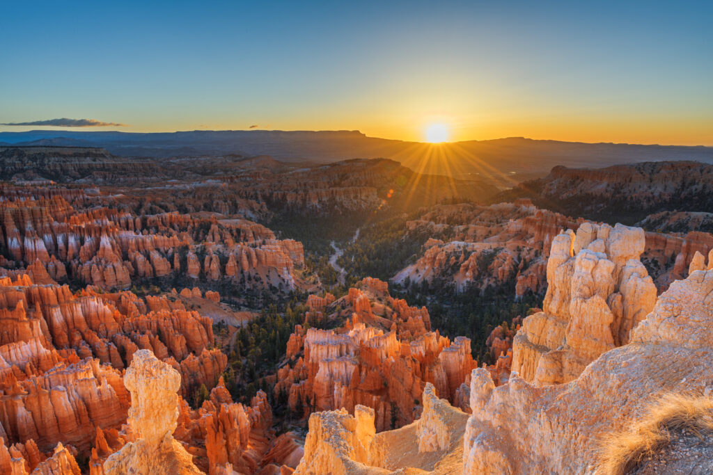
Utah’s Mighty 5 road trip is one of the greatest national park adventures in America. Five national parks. Hundreds of miles of red rock, slot canyons, hoodoos, natural arches, desert rivers, massive cliffs, and some of the darkest night skies in the country. And every park feels completely different. In Zion, you can hike through a river between thousand-foot canyon walls. At Bryce Canyon, you can walk among thousands of hoodoos. Capitol Reef combines remote desert scenery with historic fruit orchards. Arches is filled with some of the most famous natural stone formations in the world. And Canyonlands opens into an enormous landscape of cliffs, mesas, canyons, and endless sky. But planning all five parks is more complicated than simply putting them into Google Maps and driving from one to the next. You have to decide: Which direction to drive How many days to spend at each park Which hikes are actually worth your limited time Where to stay between parks Which permits you need How to avoid unnecessary backtracking Which scenic drives and detours belong in the trip How to plan around heat, elevation, crowds, and long driving days That’s where this Utah Mighty 5 road trip guide comes in. This free guide covers the basics you need to start planning, including: The best route through all five parks How many days you need The best time to visit The main highlights of each national park How to get around Where to stay What to pack A few of the best hikes The best photo spots Family travel tips For the complete planning breakdown, our Premium Ultimate Mighty 5 Utah Guide includes three complete trip plans for 5 days, 7–9 days, and 10–14 days, plus five full standalone national park guides with more than 60 detailed hikes and drives, permit information, hidden gems, lodging, dining, photography, stargazing, and more than 150 of our insider tips. 👉 Grab the complete Ultimate Mighty 5 Utah Guide in our shop and take the stress out of planning your road trip. What are Utah’s Mighty 5 National Parks? Utah’s Mighty 5 are: Zion National Park Bryce Canyon National Park Capitol Reef National Park Arches National Park Canyonlands National Park Together, they create one of the most diverse national park road trips in the country. You will experience: Towering sandstone cliffs River hikes Slot canyons Hoodoos Natural bridges Working orchards Desert arches Massive canyon overlooks Scenic highways Dark skies The full driving route covers roughly 740 miles before counting airport travel, side trips, scenic drives, and detours. That means the biggest challenge is not finding things to do. It is deciding how much you can realistically fit into the time you have. The Best Order for a Mighty 5 Road Trip For most first-time visitors, we recommend traveling west to east: 1. Zion National Park Start here after flying into Las Vegas or arriving from St. George. 2. Bryce Canyon National Park About 85 miles from Zion. 3. Capitol Reef National Park Reached from Bryce by one of the most beautiful drives in Utah. 4. Arches National Park Continue east toward Moab. 5. Canyonlands National Park Finish with the biggest, most expansive views of the trip. This route works especially well because it minimizes unnecessary backtracking and naturally follows southern Utah from southwest to southeast. The scenery also changes constantly. You begin inside Zion’s intimate canyon walls and finish looking across enormous canyon country. 💡 Pro Tip: Do not think of this as five separate vacations connected by boring drive days. Some of the roads between the parks are among the best parts of the entire trip. The premium guide includes the full route strategy and exact day-by-day trip flow. Best Time to Visit Utah’s Mighty 5 There is no single perfect month for all five parks. Elevation makes a huge difference. Zion can be extremely hot while Bryce Canyon is still cool enough to require a jacket. Spring: March–May Spring is one of the best overall seasons. You may find: Comfortable hiking weather Waterfalls Wildflowers Longer daylight hours Good road access The biggest downside is crowds. Spring break season can be extremely busy, especially in Zion, Arches, and Moab. Summer: June–August Summer offers broad access but can bring dangerous heat. At lower elevations, temperatures may climb above 100°F. Plan to: Start hikes early Carry plenty of water Avoid exposed desert trails during the hottest hours Use midday for scenic drives or rest Bryce Canyon’s higher elevation can be dramatically cooler than the other parks. Summer also brings monsoon storms and flash flood risk. Fall: September–November Fall is one of our favorite times for a Mighty 5 road trip. You may find: Cooler temperatures Better hiking weather Fall color Thinner crowds after peak season October is especially beautiful, but temperatures can change quickly between parks. Winter: December–February Winter is the quietest season. You may find: Very few visitors Snow on red rock Easier parking Lower lodging prices But some higher-elevation areas can receive significant snow and ice. Winter is beautiful—but you need flexibility. Getting To and Around Utah’s Mighty 5 A Mighty 5 road trip requires a vehicle. There is no public transportation system connecting all five parks. The most common airport options include: Las Vegas Salt Lake City St. George Grand Junction For a west-to-east trip, Las Vegas is often one of the easiest starting points. For the return trip, travelers may leave from: Grand Junction Salt Lake City Las Vegas depending on whether they are doing a one-way or round-trip route. Approximate Park-to-Park Driving Zion to Bryce Canyon About 85 miles. Allow around 1.5 to 2 hours without longer stops. Bryce Canyon to Capitol Reef About 120 miles. This drive can take much longer than the mileage suggests because the route passes through Scenic Byway 12. Do not rush it. Capitol Reef to Moab About 135 miles. The drive typically takes around 2.5 hours without major detours. Arches to Canyonlands The Island in the Sky district is roughly 30–45 minutes from
A Complete Guide to Visiting Grand Teton National Park
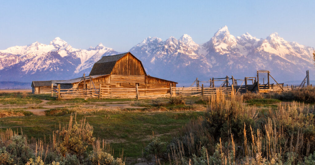
Grand Teton National Park is one of those places that almost does not look real until you see it for yourself. That’s where this Grand Teton National Park visitor guide comes in! Jagged mountain peaks rise almost straight from the valley floor. Glacial lakes reflect the mountains in the early morning. Moose wander through willow-lined wetlands. Hiking trails disappear into deep alpine canyons. Historic barns sit beneath one of the most recognizable mountain skylines in America. And unlike many mountain ranges, the Tetons have almost no foothills blocking the view. You can be driving across the flat sagebrush landscape of Jackson Hole and suddenly find yourself staring directly at a wall of 13,000-foot peaks. Grand Teton is also one of the easiest national parks to combine with Yellowstone—but it absolutely deserves its own dedicated time. This free Grand Teton National Park visitor guide covers the basics you need to start planning, including: The best time to visit The main areas of Grand Teton How to get there and get around The top things to do A few of the best hikes Where to stay Where to eat How much time you need Things to know before you go What to pack The best photo spots Family travel tips For the full planning breakdown, our Premium Grand Teton National Park Ultimate Guide includes the exact 3-day itinerary, nine complete hike and scenic-stop profiles, regional planning strategy, Jenny Lake logistics, wildlife-viewing advice, detailed lodging information, photography recommendations, 2026 trail and access updates, and everything you need to confidently organize your trip. 👉 Grab the complete Grand Teton National Park Ultimate Guide in our shop and take the stress out of planning your adventure. About Grand Teton National Park Grand Teton National Park protects one of the most dramatic mountain landscapes in America. The park is famous for: The Teton Range Jenny Lake Jackson Lake Cascade Canyon Mormon Row Schwabacher Landing Oxbow Bend Alpine lakes Moose, elk, bears, and other wildlife Some of the best hiking in the Rocky Mountains The thing that makes the Tetons look so dramatic is the way they rise almost directly from the valley floor. There is no long line of smaller foothills hiding the higher peaks. Instead, the mountains suddenly climb thousands of feet above Jackson Hole. The geology behind that scenery is equally fascinating. The Teton Range is relatively young, but much of the exposed rock is billions of years old. Glaciers also played a huge role in creating the landscape visitors see today. They carved: Deep canyons U-shaped valleys Alpine basins And left behind many of the lakes now found along the base of the mountains, including: Jenny Lake String Lake Leigh Lake Taggart Lake Bradley Lake Phelps Lake Grand Teton is also much easier to understand geographically than Yellowstone, but that does not mean you should simply make a list of attractions and drive back and forth across the park. A little planning still makes a huge difference. The Main Areas of Grand Teton National Park You do not need to memorize every road and lake before your trip, but understanding the main areas will make planning much easier. Jenny Lake For many first-time visitors, Jenny Lake is the heart of Grand Teton National Park. This area is known for: The Jenny Lake shuttle boat Hidden Falls Inspiration Point Cascade Canyon Lakeshore trails Mountain views It is also the busiest area of the park. The combination of easy scenery, popular hiking, boat access, and limited parking means the area can feel very different early in the morning than it does at midday. One of the most important things to understand before visiting Grand Teton is how you want to experience Jenny Lake. You can: Take the shuttle boat Hike around part of the lake Walk the full lakeshore Continue farther into the mountains The premium guide explains the different options and helps you decide which one makes sense for your time and hiking ability. Cascade Canyon Cascade Canyon begins beyond the popular Jenny Lake area and leads deep into the Teton Range. This is where Grand Teton starts to feel very different from a simple sightseeing park. The scenery includes: Towering canyon walls Mountain streams Wildlife habitat Alpine landscapes Longer hiking opportunities Many visitors only explore the beginning of the canyon. Others continue much farther into the high country. How far you should go depends heavily on your fitness, available time, weather, and hiking goals. String Lake and Leigh Lake String Lake is one of the best family-friendly areas in the park. The scenery is classic Grand Teton: Clear water Forest Mountain views Easy lake access The water is also relatively shallow, making this one of the more popular places for families to swim or spend part of a summer afternoon. Nearby Leigh Lake offers a quieter extension for visitors who want to keep walking. This area can be a great alternative when Jenny Lake feels overwhelmed. Taggart Lake and Bradley Lake Taggart Lake and Bradley Lake offer another classic Grand Teton experience. You will find: Mountain views Glacial lakes Forest trails Wildflower meadows These lakes are popular, but they often feel much less chaotic than Jenny Lake. They are especially worth considering for visitors who want a real hike without committing to a full-day alpine adventure. Moose and the Southern Park The Moose area is one of the main gateways into Grand Teton. Nearby attractions and routes provide access to: Teton Park Road Southern hiking areas Wildlife habitat Scenic overlooks The Moose-Wilson Road The southern part of the park can feel quieter than the Jenny Lake corridor. This area is also an important place to understand if you are planning around Phelps Lake or other southern hikes. Jackson Lake and the Northern Park The northern part of Grand Teton feels more open. Jackson Lake provides: Wide mountain views Boating Scenic pullouts Lodging Easier access toward Yellowstone This area works especially well for travelers combining both national parks. It can also be a
Moab Stargazing Guide 2026: What to Know Before You Go
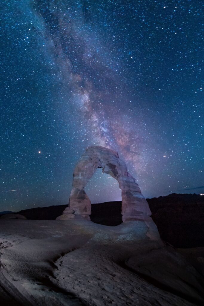
Moab is famous for red rock arches, towering sandstone cliffs, dramatic canyons, and some of the most unforgettable landscapes in Utah. But when the sun goes down, an entirely different side of Moab comes to life. Thousands of stars appear overhead. The Milky Way stretches across the desert sky. Red rock arches and sandstone towers become silhouettes against the stars. And in some of the darkest places in the region, the night sky can look almost nothing like what most of us see from home. Moab sits at the center of one of the greatest dark-sky regions in the world, surrounded by internationally recognized places including Arches National Park, Canyonlands National Park, Dead Horse Point State Park, and other remote public lands. This free Moab stargazing guide will help you get started, including: The best time to see the Milky Way in Moab A few of our favorite stargazing locations Where to go with kids What to know about moon phases Basic astrophotography tips What to pack Where to stay How to combine stargazing with an Arches or Canyonlands trip But this is just the starting point. Our Premium 21-Page Moab Astro Tourism Guide goes much deeper with all 11 of our recommended stargazing and astrophotography locations, exact access details, a complete 3-day itinerary, camera settings, gear recommendations, guided tour information, dark-sky lodging, night-access rules, and everything you need to confidently plan your own Moab night-sky adventure. 👉 Grab the complete Moab Astro Tourism Guide in our shop and take the guesswork out of planning your trip. Why Is Moab So Good for Stargazing? Moab is one of the best places in the United States to experience a truly dark night sky. Several things come together here: Very little light pollution outside town High desert elevation Dry air Huge areas of undeveloped public land Multiple protected dark-sky destinations Years of local efforts to reduce unnecessary nighttime lighting Moab itself is now an officially certified International Dark Sky Community, joining a growing number of Utah communities committed to protecting the night sky. Within easy driving distance of downtown Moab, you can also reach: Arches National Park Canyonlands National Park Dead Horse Point State Park Castle Valley Fisher Towers Potash Road The La Sal Mountains That means you can spend your day hiking beneath towering arches and your night watching the Milky Way above them. On a clear, moonless night away from town, the difference can be incredible. You may see: Thousands of stars The Milky Way stretching overhead Star clusters Meteor showers Planets Jupiter’s largest moons with binoculars Even more detail through a telescope For many families, this becomes one of the most memorable parts of a Moab trip. Best Time for Stargazing in Moab You can stargaze in Moab year-round, but what you see changes with the seasons. Spring: March–May Spring is an excellent time to visit Moab. The daytime temperatures are usually more comfortable than summer, wildflowers may be blooming, and the Milky Way’s bright galactic core begins becoming visible before sunrise. Spring works well for travelers who don’t mind getting up very early for a pre-dawn photography session. Summer: June–August Summer offers some of the longest opportunities to see the Milky Way’s bright core. The nights are warmer, which can make sitting outside under the stars more comfortable. The tradeoffs are: Hot daytime temperatures Larger crowds Summer storms Late sunsets This can still be an incredible season for night photography. Fall: September–November Fall is our favorite overall season for Moab stargazing. September and early October can offer an ideal combination of: Comfortable temperatures Thinner crowds Clearer air Early-evening Milky Way opportunities For many visitors, this is the easiest time to combine hiking, photography, and stargazing without dealing with the worst heat of summer. Winter: December–February The bright Milky Way core is below the horizon at night during winter, but that does not mean winter is a bad time for stargazing. Winter can offer: Very dark skies Clear, dry air Far fewer crowds Beautiful winter constellations Meteor showers Deep-sky viewing It is also much colder than many first-time visitors expect, so dress accordingly. The Most Important Thing to Check: The Moon Before you book a stargazing trip, check the moon phase. For the darkest sky and best view of faint stars and the Milky Way, plan around the new moon. A good rule is to aim for the few days before or after a new moon. A bright moon can wash out: Fainter stars The Milky Way Deep-sky details But a full moon is not necessarily a wasted night. Moonlight can create a completely different kind of experience, especially for: Moonlit desert walks Photographing red rock foregrounds Viewing canyon landscapes after dark Families who don’t need a completely black sky The best moon phase depends on what you want to experience. Our Premium Moab Astro Tourism Guide gives you the deeper planning strategy, including how to match your trip timing to the kind of night-sky experience you want. Best Places to Stargaze Near Moab Moab has far more night-sky locations than most first-time visitors realize. Here are a few of the easiest and most iconic places to start. Our complete premium guide includes 11 detailed locations, with access information, driving distances, difficulty levels, night-use considerations, and our insider tips for each one. Canyonlands National Park Canyonlands is one of the darkest and most spectacular places near Moab. The Island in the Sky District offers huge open horizons and dramatic canyon views, making it incredible for: Naked-eye stargazing Milky Way photography Wide-angle night landscapes Meteor showers Popular areas include the Mesa Arch and Grand View Point region. After dark, the busy daytime crowds can disappear, leaving behind a completely different experience. A few things to remember: Bring offline maps. Watch your footing around canyon rims. Bring multiple light sources. Keep white light to a minimum around other stargazers and photographers. For our exact Canyonlands night locations and planning notes, check
A Complete Guide to Visiting Great Smoky Mountains National Park
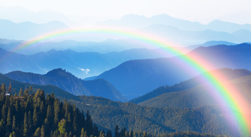
Great Smoky Mountains National Park is unlike any other national park in the country. There are no massive red rock cliffs, desert arches, or geysers exploding from the ground. Instead, the Smokies are filled with ancient mountains, endless forest, misty blue ridgelines, historic cabins, waterfalls, wildlife, and some of the most beautiful scenic roads in the eastern United States. Straddling the Tennessee–North Carolina border, Great Smoky Mountains is also the most visited national park in America. And while it does not charge an entrance fee, that does not mean there is nothing to plan. The park is huge. Cell service is limited. Popular roads can become extremely congested. Trailhead parking fills early. Weather changes quickly. And because the park has several different gateway towns and regions, where you stay can completely change your trip. This free Great Smoky Mountains National Park visitor guide covers the basics you need to start planning, including: The best time to visit How the parking tag system works The main areas of the park How to get there and get around A few of the best things to do Some of the most popular hikes How much time you need Where to stay Wildlife and family tips What to pack For the full planning breakdown, our Premium Great Smoky Mountains National Park Ultimate Guide includes a complete 3-day itinerary, nine detailed trail and experience profiles, road and crowd strategy, synchronous firefly information, hiking logistics, photography tips, lodging recommendations, gateway town comparisons, safety information, and everything you need to confidently organize your trip. 👉 Grab the complete Great Smoky Mountains National Park Ultimate Guide in our shop and take the stress out of planning your adventure. About Great Smoky Mountains National Park Great Smoky Mountains National Park stretches across the Tennessee–North Carolina border in the southern Appalachian Mountains. The park is known for: Layered blue mountain views Waterfalls Dense forest Historic homesteads Scenic drives Black bears Elk Wildflowers Fall colors Synchronous fireflies The Smokies are part of one of the oldest mountain ranges on Earth. Millions of years of erosion have softened the landscape into the rounded, forest-covered peaks that make the park look so different from younger mountain ranges in the western United States. The famous blue haze is also real. The dense forest releases natural organic compounds that scatter blue light, creating the smoky appearance that gives the mountains their name. Great Smoky Mountains is also one of the most biodiverse places in the National Park System, with thousands of documented species and new species still being identified. It is especially famous for salamanders, earning the region the nickname “Salamander Capital of the World.” The Main Areas of Great Smoky Mountains National Park The Smokies do not have one central scenic loop that connects everything. Instead, different roads and regions offer very different experiences. Understanding those areas before your trip will save you a lot of unnecessary driving. Cades Cove Cades Cove is one of the most famous areas in the park. The valley is known for: Wildlife Historic cabins Churches Open meadows Mountain views Scenic driving The one-way loop is beautiful—but it can also be one of the slowest drives in the park when traffic or wildlife stops vehicles. Early morning is usually the best time to visit. Newfound Gap Road Newfound Gap Road crosses the park between Gatlinburg, Tennessee, and Cherokee, North Carolina. Along the way, you will find: Mountain overlooks Trailheads The Tennessee–North Carolina state line Access toward Kuwohi Dramatic elevation changes This is one of the best roads for getting a broad feel for the Smokies. Kuwohi Formerly known as Clingmans Dome, Kuwohi is the highest point in Great Smoky Mountains National Park. A short but steep paved trail leads to the famous observation tower. On a clear day, the views can stretch across layer after layer of mountain ridges. On a hazy day, visibility may be much more limited. That unpredictability is part of the Smokies experience. Roaring Fork The Roaring Fork area sits near Gatlinburg and offers: A scenic motor nature trail Historic cabins Forest scenery Waterfalls Popular hiking access This area works especially well for travelers staying in Gatlinburg. Cataloochee Valley Cataloochee is one of the park’s more remote regions. It is best known for the elk that were reintroduced to the Smokies. This area requires more effort to reach, but that also means it often feels quieter than the busiest Tennessee-side attractions. The full premium guide helps you decide whether Cataloochee is worth adding based on the number of days you have. Best Time to Visit The Smokies are beautiful year-round, but every season offers something different. Spring: April–May Spring is one of the best times to visit. This season brings: Wildflowers Stronger waterfall flow Fresh green forest Comfortable hiking temperatures Late spring is also associated with the park’s famous synchronous firefly event. Because access to the managed firefly viewing period is limited, it requires advance planning. Summer: June–August Summer is warm, humid, and busy. Expect: Thick green forest Frequent rain Hazy mountain views Heavy weekend crowds This is a popular family-travel season, but starting early becomes especially important. Fall: September–October Fall is one of the most beautiful—and busiest—times in the Smokies. The mountains transform with: Red Orange Gold Yellow The challenge is traffic. October can bring extremely heavy congestion, especially on scenic roads and around Cades Cove. Winter: November–March Winter is one of the most underrated times to visit. You may find: Far fewer crowds Clearer views through bare trees Snow at higher elevations A quieter park experience Some high-elevation roads may close because of snow or ice. Getting To and Around Great Smoky Mountains National Park The park has no central shuttle system. For most trips, you will need your own vehicle. The most common gateway towns include: Gatlinburg, Tennessee Pigeon Forge, Tennessee Townsend, Tennessee Cherokee, North Carolina Bryson City, North Carolina Each one works best for different parts of the park. Gatlinburg Best for: Sugarlands Newfound Gap Road Roaring Fork Popular Tennessee-side
A Complete Guide to Visiting Yellowstone National Park
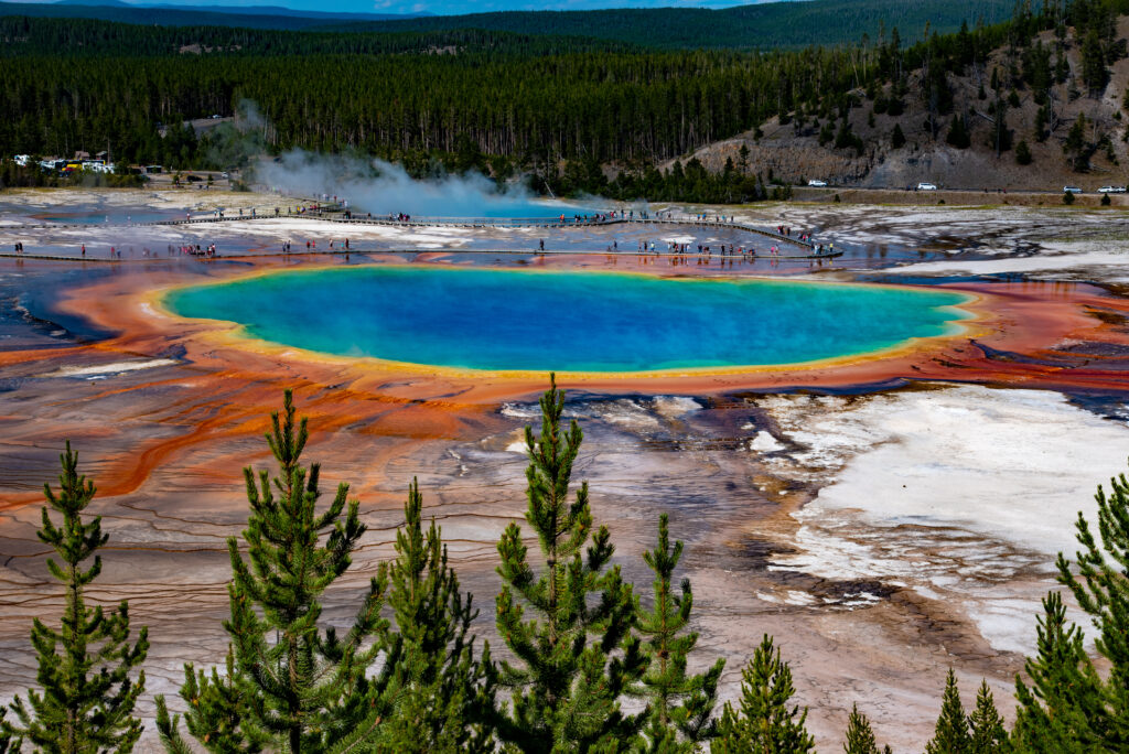
Yellowstone National Park is one of those places that almost feels impossible until you see it for yourself. That’s where this Yellowstone National Park visitor guide comes in! Geysers erupt from the ground. Brilliant blue and orange hot springs look almost unreal. Huge herds of bison wander through wide-open valleys. Wolves move across the landscape in the distance. Waterfalls plunge into colorful canyons. And beneath all of it sits one of the largest active volcanic systems in the world. Established in 1872, Yellowstone became the world’s first national park—and more than 150 years later, it is still one of the most extraordinary places in America. But Yellowstone is also much bigger and more complicated to plan than many first-time visitors expect. The park covers more than 2 million acres, has five entrances, hundreds of miles of roads, several major geothermal regions, huge wildlife valleys, and enough things to do that you could easily spend a full week here. This free Yellowstone National Park visitor guide covers the basics you need to start planning, including: The best time to visit The main areas of Yellowstone How to get there and get around The top things to do A few of the best hikes and walks How much time you need Where to stay Wildlife safety What to pack For the full planning breakdown, our Premium Yellowstone National Park Ultimate Guide includes the exact 3-day itinerary, regional planning strategy, complete hike and boardwalk profiles, wildlife-viewing advice, detailed lodging options, photography tips, road and entrance information, and everything you need to confidently organize your trip. 👉 Grab the complete Yellowstone National Park Ultimate Guide in our shop and take the stress out of planning your adventure. About Yellowstone National Park Yellowstone National Park covers approximately 2.2 million acres across Wyoming, Montana, and Idaho, with most of the park located in Wyoming. The park is famous for: Old Faithful Grand Prismatic Spring The Grand Canyon of the Yellowstone Lamar Valley Hayden Valley Mammoth Hot Springs Yellowstone Lake Hundreds of geysers and hot springs Bison, wolves, grizzly bears, elk, and other wildlife Nearly everything that makes Yellowstone unique connects back to the volcanic system beneath the park. The heat underground powers an incredible collection of: Geysers Hot springs Mudpots Fumaroles Yellowstone contains more geothermal features than anywhere else on Earth and roughly half of the world’s known geysers. But what surprises many first-time visitors most is not the geology. It is the size. Yellowstone is not one compact destination where every attraction sits close together. The roads form a large figure-eight through several different regions, and driving between them can take much longer than it appears on a map. That is why a realistic plan matters so much here. Before visiting, remember to follow Leave No Trace principles, respect wildlife, stay on designated trails, and never step off the boardwalk in a thermal area. The ground around geothermal features can look completely solid while hiding scalding water and dangerously thin crust underneath. The Main Areas of Yellowstone National Park You do not need to memorize the entire park before your trip, but understanding the major regions will make planning much easier. Old Faithful and the Upper Geyser Basin For most first-time visitors, this is the classic Yellowstone experience. Old Faithful is the park’s most famous geyser, but the surrounding Upper Geyser Basin contains much more than one eruption. You will also find: Geothermal boardwalks Hot springs Other major geysers Historic Old Faithful Inn Visitor services Dining and lodging One of the biggest mistakes visitors make is watching Old Faithful erupt and immediately leaving. The larger basin is absolutely worth exploring. Grand Prismatic Spring and the Midway Area Grand Prismatic Spring is one of Yellowstone’s most recognizable landmarks. The brilliant blue center and rings of yellow, orange, and green create one of the most incredible natural landscapes in the park. There are different ways to experience the spring, including: A closer boardwalk view An elevated view from a nearby trail Each gives you a completely different perspective. The full premium guide explains how to work this area into your day without duplicating unnecessary driving. The Grand Canyon of the Yellowstone The Yellowstone River carved a dramatic canyon filled with yellow, orange, and pink rock. This area is known for: Upper Falls Lower Falls Artist Point North Rim viewpoints South Rim viewpoints Short hikes and overlooks It is one of the most visually dramatic areas in the entire park. Do not treat it as one quick roadside photo stop. Lamar Valley Lamar Valley is one of the greatest wildlife-viewing destinations in the United States. Visitors come here hoping to see: Wolves Bison Grizzly bears Pronghorn Coyotes Other wildlife The valley is especially popular with serious wildlife watchers carrying: Binoculars Spotting scopes Long camera lenses Early mornings and evenings are generally the most rewarding. Hayden Valley Hayden Valley is another major wildlife corridor. Large bison herds are common, and wildlife frequently creates traffic backups. Because Hayden Valley is more centrally located than Lamar Valley, it can be easier to combine with other sightseeing areas. Just remember that a road that looks like a short drive on a map can become a much longer one when a herd of bison decides to stand in the road. Mammoth Hot Springs Mammoth looks completely different from Yellowstone’s other thermal areas. Instead of colorful pools and erupting geysers, hot water flowing through limestone creates enormous white, orange, and cream-colored travertine terraces. The Mammoth area is also known for: Historic Fort Yellowstone Elk Nearby lodging The North Entrance Year-round vehicle access from Gardiner Yellowstone Lake and West Thumb Yellowstone Lake is one of the largest high-elevation lakes in North America. Nearby West Thumb Geyser Basin combines: Hot springs Geysers Lake views Mountain scenery This area works especially well for travelers moving between Yellowstone and Grand Teton National Park. Best Time to Visit Yellowstone is open year-round, but each season offers a completely different experience. Spring: April–May Spring is one of the best
A Complete Guide to Visiting Glacier National Park
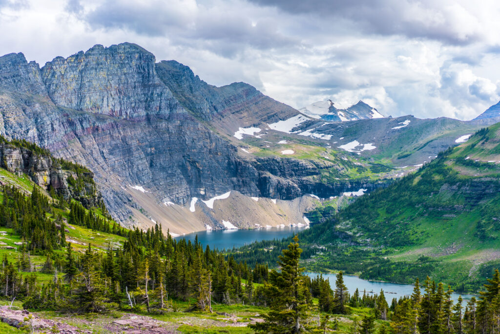
Glacier National Park is one of those places that almost doesn’t seem real until you see it for yourself. Turquoise lakes. Jagged mountain peaks. Alpine meadows covered in wildflowers. Waterfalls spilling down mountainsides. Historic lodges. Wildlife around almost every corner. And one of the most spectacular scenic roads in the United States. Located in northwestern Montana along the Canadian border, Glacier National Park is known as the Crown of the Continent—and once you visit, it’s easy to see why. But Glacier is also a park that takes a little more planning than many first-time visitors expect. The park is huge, its major areas are spread out, mountain roads are seasonal, weather can change quickly, and some of the most popular places can become very busy. This free Glacier National Park visitor guide will help you understand the basics, including: The best time to visit The main areas of the park The top things to do A few of the best hikes How much time you need Where to stay What to pack Important things to know before you go For the full planning breakdown—including our detailed itineraries, complete hiking guide, Going-to-the-Sun Road strategy, Logan Pass logistics, where to stay by region, photography locations, parking tips, and everything we use to plan a Glacier trip—grab our Premium Glacier National Park Guide in our shop. About Glacier National Park Glacier National Park sits along the Continental Divide in northwestern Montana and protects a spectacular landscape of mountains, lakes, forests, waterfalls, alpine meadows, and glacially carved valleys. The park is best known for places like: Going-to-the-Sun Road Lake McDonald Logan Pass Many Glacier St. Mary Lake Two Medicine Hidden Lake Overlook Avalanche Lake Grinnell Glacier What surprises many first-time visitors is that Glacier does not feel like one single park area. It is divided into several distinct regions, and driving from one part of the park to another can take much longer than you expect. The west side feels different from Many Glacier. Two Medicine offers a different experience from Logan Pass. The remote North Fork feels completely different from all of them. That is one of the things that makes Glacier so incredible—but it is also why having a good plan matters. Before visiting, remember to follow Leave No Trace principles. Stay on designated trails, pack out your trash, respect wildlife, never feed animals, and help protect this incredible landscape for future generations. You don’t need to understand every corner of Glacier before your trip, but knowing the major areas will make planning much easier. The Main Areas of Glacier National Park Going-to-the-Sun Road For most first-time visitors, this is the classic Glacier experience. Going-to-the-Sun Road crosses the park between West Glacier and St. Mary, climbing through forests and past waterfalls before reaching the Continental Divide at Logan Pass. Along the way, you’ll find some of Glacier’s most famous scenery, viewpoints, and trailheads. Lake McDonald Valley Located on the west side of the park, the Lake McDonald area is one of the easiest places to reach. This area is known for: Lake McDonald Colorful shoreline rocks Lake McDonald Lodge Trail of the Cedars Avalanche Lake It’s a great introduction to Glacier and especially good for families and first-time visitors. Logan Pass Logan Pass sits high along the Continental Divide and is one of the most spectacular areas in the park. It provides access to famous trails and is known for alpine scenery, wildflowers, mountain goats, and incredible views. It is also one of the busiest areas in Glacier, so understanding the current parking and shuttle system before your trip is extremely important. Many Glacier If hiking and dramatic mountain scenery are at the top of your list, Many Glacier deserves a place in your itinerary. This area is known for: Grinnell Glacier Iceberg Lake Swiftcurrent Lake Wildlife viewing Many Glacier Hotel Many Glacier feels like the heart of the park and has some of the most incredible scenery in Glacier. Two Medicine Two Medicine is a quieter part of the park that many first-time visitors overlook. You’ll find mountain views, waterfalls, trails, lake experiences, and a more relaxed atmosphere than some of Glacier’s busiest areas. If you have several days, it is absolutely worth considering. Best Time to Visit Glacier can be visited year-round, but the experience changes dramatically with the seasons. Spring: May–Mid-June Spring is beautiful, but access can be limited. Lower-elevation areas may be open while higher roads and trails are still covered in snow. Spring can be a good choice for: Fewer crowds Waterfalls Lower-elevation exploring Biking or walking sections of Going-to-the-Sun Road before it fully opens to vehicles You will need to be flexible because snow conditions control what is accessible. Summer: Mid-June–August Summer is Glacier’s busiest season and generally offers the greatest access to roads, trails, tours, and park services. July and August are ideal for visitors who want: High-elevation hiking Going-to-the-Sun Road Logan Pass Wildflowers Boat tours The widest range of available activities The tradeoff is larger crowds and more competition for parking. Fall: September–October Fall is one of our favorite times to visit Glacier. Crowds begin to thin after Labor Day, hiking temperatures become more comfortable, and the landscape begins changing color. Early and mid-September can offer a great balance of: Open trails Cooler weather Fewer crowds Wildlife activity Beautiful fall scenery Services begin closing as the season progresses, and mountain weather can change quickly. Winter: November–April Winter is quiet and beautiful, but access is limited. Much of the park becomes a destination for: Snowshoeing Cross-country skiing Winter photography Solitude Most first-time visitors looking for the full Glacier experience should plan for summer or early fall. Top Things to Do Drive Going-to-the-Sun Road Going-to-the-Sun Road is one of the most spectacular scenic drives in America and an essential part of a first trip to Glacier. The road climbs from forest and lake country into dramatic alpine scenery before crossing the Continental Divide at Logan Pass. Some of the places you may want to see
A Complete Guide to Visiting Zion National Park
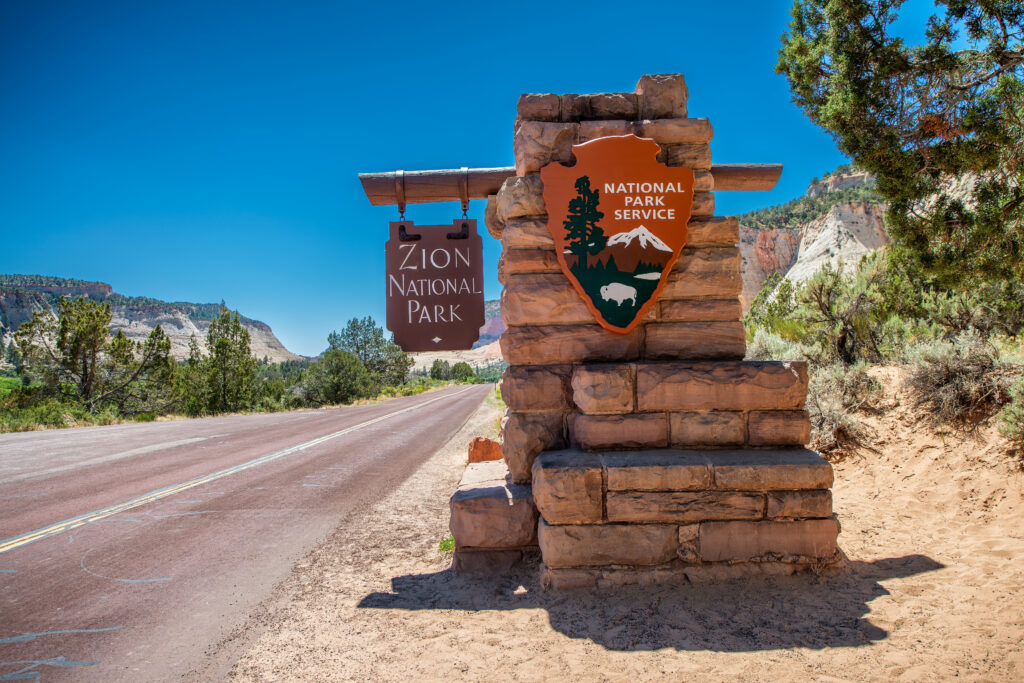
Zion National Park is one of the most iconic national parks in the United States—and for good reason. Towering sandstone cliffs, scenic canyon roads, river walks, famous hikes, and red rock views make this one of the most unforgettable places to visit in Utah. That’s where this Zion National Park visitor guide comes in! Located in the southwest corner of the state, Zion is part of Utah’s Mighty 5 and is a must-see stop on any Southern Utah road trip. Whether you’re planning your first visit, traveling with kids, or trying to fit Zion into a longer Utah itinerary, this guide will help you get started. This free Zion National Park visitor guide covers the basics—when to go, what to know, a few top hikes, where to stay, and how to avoid some of the biggest first-time mistakes. If you want the full planning breakdown, including detailed itineraries, trail notes, shuttle strategy, hidden gems, lodging recommendations, restaurant picks, and everything we use to plan our own Zion trips, be sure to grab our Premium Zion National Park Guide in our shop. About Zion National Park Zion National Park is known for its massive sandstone cliffs, narrow canyons, desert scenery, and the Virgin River, which carved the canyon over millions of years. The park is famous for hikes like Angels Landing, The Narrows, Emerald Pools, Canyon Overlook, and Watchman Trail. But Zion is more than just hiking. You’ll also find scenic drives, viewpoints, wildlife, photography spots, family-friendly walks, and nearby adventure experiences in Springdale and East Zion. Zion is open year-round, but your experience can feel completely different depending on the season, weather, shuttle schedule, and crowd levels. Before you visit, remember to follow the Leave No Trace principles. Stay on designated trails, pack out your trash, respect wildlife, avoid carving or writing on rocks, and be considerate of other visitors so Zion can be protected for future generations. Before embarking on your adventure, please review the Leave No Trace principles to ensure you leave every place better than you found it, so that others can enjoy these beautiful places for many years to come! These seven principles include planning ahead and preparing, hiking and camping on durable surfaces, disposing of waste properly (pack out what you pack in!), understanding campfire rules and always fully extinguishing your fires, respecting wildlife, and being considerate of other visitors. Best Time to Visit Zion is beautiful year-round, but some seasons are much easier to plan around than others. Spring: March–May Spring is one of the best times to visit Zion. Temperatures are usually comfortable, waterfalls may be flowing, and wildflowers start to appear throughout the canyon. Spring is also a popular season, especially around spring break, so expect crowds to build quickly. Summer: June–August Summer brings long days, hot temperatures, and some of the biggest crowds of the year. Afternoon temperatures can get extremely hot, so early morning hikes are best. This is also part of flash flood season, so always check current park conditions before entering The Narrows or any slot canyon. Fall: September–November Fall is one of our favorite times to visit Zion. Temperatures are more comfortable, the cottonwoods turn golden, and the park is still beautiful without the worst of the summer heat. October is especially popular because of the fall colors and great hiking weather. Winter: December–February Winter is the quietest season in Zion. You may see snow on the red rocks, which is absolutely beautiful, and crowds are much lighter. Some trails can be icy, and shuttle operations may be limited depending on the season, so check current conditions before your trip. Top Things to Do Ride the Zion Shuttle Through the Main Canyon Even if you only have one day in Zion, riding the shuttle through Zion Canyon is one of the best ways to see the park. The shuttle takes you to many of the most popular stops and trailheads, including: Court of the Patriarchs Zion Lodge The Grotto Big Bend Temple of Sinawava This is the classic Zion experience and a great way to get your first look at the canyon. Hike the Riverside Walk The Riverside Walk is one of the most accessible and family-friendly walks in Zion. It begins at the Temple of Sinawava, the last stop on the Zion Canyon shuttle, and follows the Virgin River into a beautiful canyon. This trail is also the beginning of the famous Narrows hike. It’s a great option if you want canyon views without doing a strenuous hike. Experience The Narrows The Narrows is one of Zion’s most unique hikes. Instead of hiking on a traditional dirt trail, you walk through the Virgin River between towering canyon walls. The bottom-up Narrows hike does not require a permit, but conditions matter a lot. Water levels, weather, and flash flood risk can change quickly. Before hiking The Narrows: Check current park conditions Check flash flood warnings Wear proper footwear (we LOVE Zion Guru, and if you use code AFV10 you can save 10% on all your rentals with them!) Consider renting Narrows gear in Springdale Do not enter if storms are in the forecast The Narrows is incredible, but it’s not a hike to take lightly. Hike Canyon Overlook Trail Canyon Overlook is one of the best short hikes in Zion. It’s located on the east side of the Zion-Mount Carmel Tunnel and offers a huge canyon view without a long hike. This is a great option for families, first-time visitors, or anyone who wants a big payoff with less mileage. Parking is limited, so go early if this hike is on your list. Visit Emerald Pools Emerald Pools is one of Zion’s classic hikes and a good option for visitors who want a shorter trail from the main canyon. There are lower, middle, and upper pool areas, so you can make this hike shorter or longer depending on your time, energy, and trail conditions. This area can get very busy, especially during peak season, so starting
A Complete Guide to Visiting Capitol Reef National Park
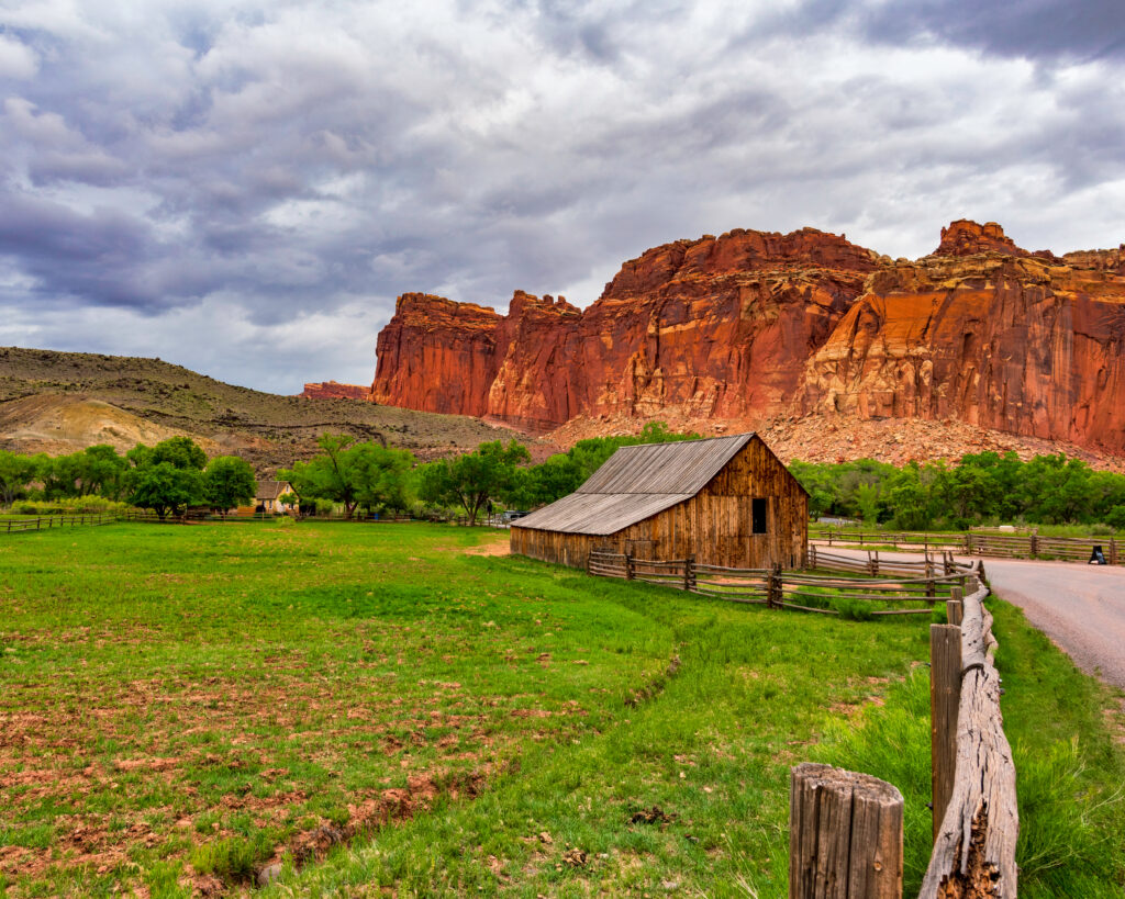
If you’re looking for one of Utah’s most underrated national parks, Capitol Reef National Park deserves a spot on your itinerary. While many visitors head straight to Zion or Arches, Capitol Reef offers incredible red rock cliffs, towering domes, natural bridges, slot canyons, scenic drives, orchards, and some of the best stargazing in the country—all without the massive crowds. Whether you’re spending a few hours or a full day exploring the park, this guide covers everything you need to know before you go. If you want the full planning breakdown, including detailed itineraries, trail notes, shuttle strategy, hidden gems, lodging recommendations, restaurant picks, and everything we use to plan our own Capitol Reef trips, be sure to grab our Premium Capitol Reef National Park Guide in our shop. About Capitol Reef National Park Located in south-central Utah, Capitol Reef National Park protects nearly 242,000 acres of colorful cliffs, deep canyons, sandstone domes, and the fascinating Waterpocket Fold—a nearly 100-mile-long wrinkle in the Earth’s crust created millions of years ago. Unlike many national parks, Capitol Reef still preserves the historic Fruita settlement, where visitors can stroll through orchards, explore pioneer buildings, and even purchase fresh fruit or homemade pies during harvest season. Capitol Reef is one of Utah’s Mighty 5 National Parks and offers incredible scenery with far fewer crowds than many of the state’s more famous parks. Before you visit, remember to practice the seven Leave No Trace principles so future generations can enjoy this incredible landscape. Before embarking on your adventure, please review the Leave No Trace principles to ensure you leave every place better than you found it, so that others can enjoy these beautiful places for many years to come! These seven principles include planning ahead and preparing, hiking and camping on durable surfaces, disposing of waste properly (pack out what you pack in!), understanding campfire rules and always fully extinguishing your fires, respecting wildlife, and being considerate of other visitors. Best Time to Visit 🌸 Spring (March–May) Mild temperatures Wildflowers begin blooming Fruita orchards burst into blossom ☀️ Summer (June–August) Hot afternoons Start hikes early Afternoon thunderstorms are common 🍂 Fall (September–October) Cooler temperatures Fruit harvest season Beautiful fall colors throughout the orchards ❄️ Winter (November–February) Quietest time of year Occasional snow creates beautiful contrast against the red cliffs Great time to avoid crowds Top Things to Do Drive the Capitol Reef Scenic Drive The park’s scenic drive is one of the easiest ways to experience Capitol Reef. The paved route winds past towering cliffs, colorful rock formations, and access to several popular hiking trails. Explore Fruita Historic District Visit the historic orchards, schoolhouse, blacksmith shop, and the famous Gifford House, where you can purchase homemade pies, cinnamon rolls, jams, and locally made gifts. Hike Hickman Bridge One of the park’s most popular hikes, this relatively short trail leads to a spectacular 133-foot natural bridge overlooking beautiful desert scenery. Visit the Petroglyph Panel Just a few minutes from the visitor center, this roadside stop features ancient Fremont petroglyphs carved into the sandstone hundreds of years ago. Explore Capitol Gorge Walk through a narrow canyon filled with towering walls, pioneer inscriptions, and beautiful rock formations. Getting To and Around Capitol Reef National Park The closest gateway town is Torrey, Utah, located just minutes from the park entrance. Closest airports Salt Lake City (SLC) – About 3.5–4 hours St. George (SGU) – About 3.5 hours Las Vegas (LAS) – About 5 hours A personal vehicle is highly recommended since there is no shuttle system inside the park. Where To Stay Near Capitol Reef National Park The best place to stay when visiting Capitol Reef is Torrey, Utah, a small gateway town just minutes from the park entrance. Torrey has a mix of hotels, resorts, cabins, RV parks, and vacation rentals, making it a convenient basecamp for exploring Capitol Reef. A few places to look into include: Cougar Ridge Resort – A luxury ranch-style resort near Torrey with spacious accommodations, red rock views, and a more upscale adventure feel. Capitol Reef Resort – One of the closest resort-style stays near the park, located just outside the entrance with unique lodging options and beautiful red cliff views. Red Sands Hotel – A modern hotel in Torrey with comfortable rooms, an indoor pool, spa, and restaurant. Broken Spur Inn & Steakhouse – A family-friendly hotel with red rock views, breakfast, an on-site steakhouse, and unique covered wagon stays. Fruita Campground – The main campground inside Capitol Reef National Park, located in the beautiful Fruita Historic District near the orchards. For the easiest trip, we recommend staying in or near Torrey so you can get into the park early, enjoy sunset views, and have easy access to restaurants after a full day of exploring. Be sure to grab our Premium Capitol Reef National Park Guide for even more details and discounts. How Much Time Do You Need at Capitol Reef National Park? Half Day Scenic Drive Fruita Historic District Petroglyph Panel Gifford House One Full Day Add Hickman Bridge Capitol Gorge Sunset viewpoints Two Days or More Explore Cathedral Valley Drive the Burr Trail Additional hikes Stargazing Things to Know Before You Go No shuttle system Cell service is limited throughout much of the park Fill up on gas before arriving Bring plenty of water, especially during summer Flash floods are possible during monsoon season Many backcountry roads require a high-clearance or four-wheel-drive vehicle 💡 Pro Tip: Don’t leave without stopping at Gifford House for one of their famous homemade pies. They often sell out during busy seasons. What to Pack Daypack Comfortable hiking shoes Plenty of water Hat Sunglasses Sunscreen Offline maps Camera Snacks Don’t Miss These Photo Spots Hickman Bridge Panorama Point Sunset Point Fruita Orchards Capitol Gorge Looking for a Complete Capitol Reef Guide? This guide covers the highlights, but our Premium Capitol Reef Guide includes: Detailed day-by-day itineraries Every major hike with difficulty ratings Hidden gems most visitors miss Scenic pullouts and photography locations Family-friendly activities Restaurant
Red Rock Plunge Moab: Incredible Sauna & Cold Plunge Recovery Experience
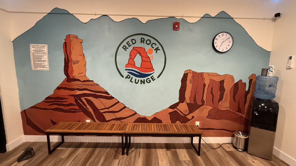
If you’ve spent even one full day in Moab — hiking, biking, scrambling over rocks, or just baking in the desert sun — you know how wrecked your body can feel by the end of the day. That’s exactly why we decided to try Red Rock Plunge, and honestly… it might be one of our favorite experiences we’ve had in Moab that isn’t a hike or an adventure tour. This isn’t just a “nice spa moment.” It’s a hot sauna + cold plunge contrast therapy experience that leaves you feeling relaxed, energized, and weirdly ready to do it all over again the next day. Let me tell you what it’s actually like — and why you should absolutely put this on your Moab list. If you want more Moab tips check out our other blogs! What Red Rock Plunge Is (and Why It’s So Good) Red Rock Plunge in Moab is a destination for sauna and cold plunge contrast therapy — an immersive recovery experience that pairs intense heat with icy water to help your body reset. You go in the sauna to warm up, slide into a cold plunge pool to reset, and repeat the cycle during your session. This style of contrast therapy has been used by athletes, outdoor enthusiasts, and wellness fans around the world because it helps speed up recovery, improve circulation, and promote relaxation — all of which feel amazing after long days exploring places like Arches National Park or Canyonlands National Park. You don’t need to be a wellness expert or an athlete to enjoy this. You just need sore legs, a tired back, or a desire to feel amazing again. What the Red Rock Plunge Experience Actually Feels Like Step One: The Sauna When you walk into the sauna at Red Rock Plunge, the first thing you notice is how the heat doesn’t just warm your skin — it sinks in. After a long desert day, that deep warmth is instantly relaxing. This is a 70-minute session, so there’s plenty of time to settle into the heat. The lighting in the whole room is adjustable, so you can dial in a vibe that feels calming — dim and peaceful, cozy and warm, or whatever helps you unwind. Helpful tip: If you’re new to saunas, start with 8–15 minutes in the heat to let your body acclimate. Bring a water bottle and sip as you go — hydration matters. Step Two: The Cold Plunge (Yes, It’s Cold) Then comes the cold plunge — and I won’t sugarcoat it — stepping into that cold water is an experience. But it’s a good kind of experience. That initial shock transitions quickly to a calm, invigorating sensation that makes your body feel alive again. Most people stay in for 1–3 minutes — and even that short time delivers real benefits. The cold helps reduce inflammation, boosts circulation, and gives you that clear-headed reset you didn’t even know you needed. Pro tip: Slow, steady breathing makes it way easier. You’ll be amazed how much better 60–90 seconds feels once your body settles. Step Three: Repeat (The Magic) The real payoff comes from cycling back to the sauna after the plunge. Each round feels smoother, more restorative, and strangely addicting. By the end of your session, you’ll feel both relaxed and refreshed — like your body found its reset button. Red Rock Plunge Space & Amenities (Thoughtful Details Matter) This isn’t a rushed experience. You’ve got room to breathe and space to reset. Here are a few things we loved about the setup: 70-minute sessions give you plenty of time — no feeling rushed Shower on site to rinse off before or after your plunge Towels provided so you don’t have to bring your own Separate bathroom for convenience Adjustable lighting to set a relaxing, calm mood It feels intentional, peaceful, and well-designed — not rushed or chaotic. Red Rock Plunge Pricing & Booking Exact pricing for Red Rock Plunge sessions varies by season and availability, and is best confirmed directly when you book. One cool part is that you can book one session for multiple people, so if you want to go as a couple or a family you can! Just understand that it’s an 18 and older experience, so no children can do it for liability reasons. At the time of this writing, each 70-minute session can accommodate up to 4 people, and pricing is based on group size: 1 person: $50 2 people: $60 3 people: $70 4 people: $80 👉 Book your session here: https://red-rock-plunge.gymdesk.com/book Red Rock Plunge Booking ahead ensures you get the time that works best for your itinerary. Why Red Rock Plunge Is Perfect After Exploring Moab If you’re hiking places like Delicate Arch, Devils Garden, Upheaval Dome, or biking slickrock under the hot desert sun, this experience feels like hitting a reset button. Here’s why we loved it so much: Helps reduce muscle soreness and stiffness Supports recovery if you’re doing multiple park days in a row Clears your head mentally after long, hot days outside Offers a unique experience that isn’t another hike or tour It’s the kind of thing that makes the rest of your trip better. What to Bring & Know Before You Go Swimsuit or comfortable athletic wear A water bottle (hydration matters!) An open mind if it’s your first cold plunge Towels are provided — but you might still want your own flip-flops or sandals You don’t need to stay in the cold long to benefit — short dips are still incredibly effective. Who This Experience Is Great For Hikers and outdoor adventurers Road trippers passing through Moab Couples looking for something unique Families with older teens Anyone wanting recovery without a full spa day If you’re active in Moab, this experience just makes sense. Book your Red Rock Plunge session here. Final Thoughts on Red Rock Plunge If you’re planning a trip to Moab and want to actually enjoy your adventures without feeling destroyed
JUMP by Limitless Flight: The Ultimate Wingsuit Flight Simulator in Utah
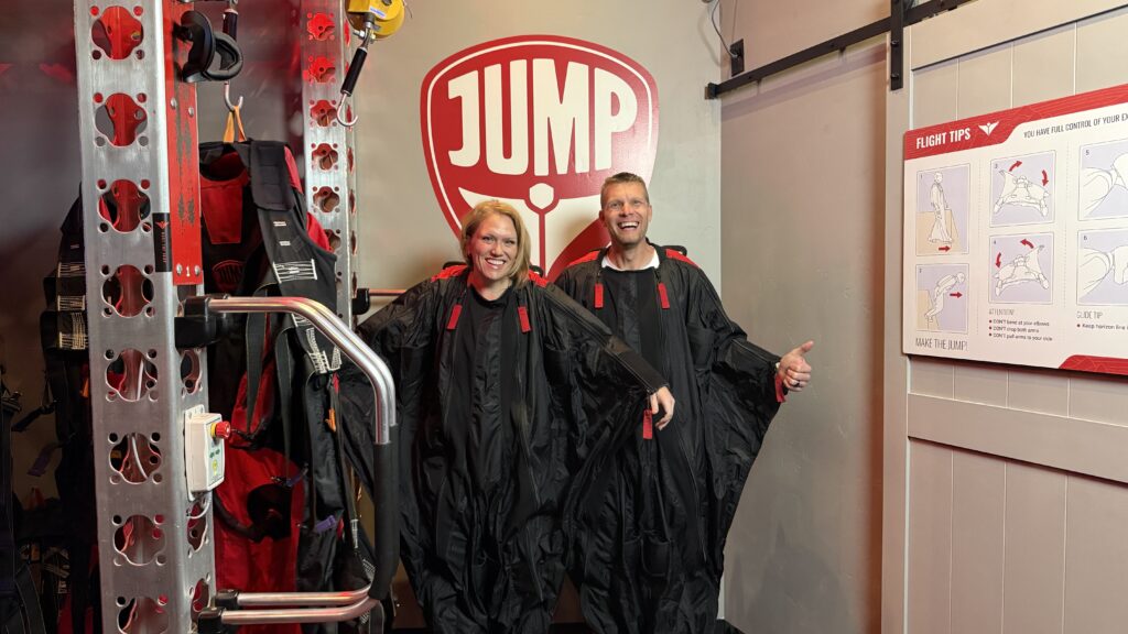
Have you ever dreamed of flying? Like, really flying — wings stretched out, soaring over cliffs, the wind roaring past your face? That’s exactly what we experienced at JUMP by Limitless Flight in Bluffdale, Utah, a wingsuit flight simulator, and honestly… it blew our minds! This isn’t your average virtual reality attraction — it’s a full-body, heart-pounding, grin-until-your-cheeks-hurt kind of experience. Whether you’re looking for a wild date idea, an epic family adventure near Salt Lake City, or just something new to brag about on your Instagram, JUMP is the kind of story you’ll still be talking about days later. What Is JUMP by Limitless Flight? (aka the coolest thing we’ve ever done indoors) JUMP by Limitless Flight is a world-class wingsuit and BASE-jump wingsuit flight simulator right here in Bluffdale, Utah — about 25 minutes south of Salt Lake City. You strap into a real wingsuit, gear up with a VR headset, and literally fly through three ultra-realistic experiences — from skydiving out of a plane to BASE jumping off massive cliffs. It’s part flight simulator, part extreme sport, and 100% adrenaline rush. Our Experience — From Check-In to Touchdown 1️⃣ Check-In at Basecamp We pulled up to JUMP’s hangar-style facility in Bluffdale and instantly got the vibe — sleek, modern, and filled with energy. The team greeted us like old friends and walked us through check-in. The pre-flight briefing was quick but super clear — everything from safety to how to steer in the virtual sky. 💡 Tip: Arrive 10–15 minutes early so you can fill out paperwork, relax, get suited up, and enjoy the Basecamp lounge. 2️⃣ Suiting Up — Things Just Got Real Once we stepped into the wingsuits, things got real. They’re actual, weighted suits used in real wingsuit training, so you instantly feel like a pro BASE jumper. You’ll be wearing about 25-35 pounds of gear. Add in the harness, helmet, and gloves, and suddenly you feel like a you’re literally about to jump out of a plane or base jump! 💡 What to wear: Athletic clothes work best — leggings, joggers, or shorts, depending on the season. 3️⃣ The Flight — Three Jumps, Endless Thrills When the fans kicked on and the visuals surrounded us, it felt like we’d left Utah entirely. The first jump? A high-altitude skydive over stunning landscapes. You try to fly through these targets to get used to maneuvering in the air with the wingsuit. This was super cool and you actually get the hang of it pretty quickly. Then came two BASE jumps — soaring off cliffs, weaving through canyons, and pulling the parachute right before landing. The wind, the speed, the realism — we were screaming and laughing the entire time. Jesse loved steering through canyons and kept saying, “This is so awesome!” 💡 Pro Tip: Don’t fight the motion — go with it! The more you relax and “fly,” the more natural it feels. 4️⃣ Post-Flight Lounge & Reactions After our flight, we headed to the lounge area to catch our breath and watch our flight highlights. Seeing ourselves diving and soaring on screen was SO fun. They even emailed us the footage so we could relive it (and post it 😎). 💡 Pro Tip: Bring your phone — they’ll send your highlight reel right after the session! Who Should Try JUMP? Honestly? Pretty much everyone who loves adventure. This wingsuit flight simulator is amazing! The great part is even people into their 60s, 70s, and 80s can do this…there’s virtually no stress on the body! ✅ Couples – Want a date that’s way cooler than dinner and a movie? ✅ Families – Great for teens and older kids (minimum 70 lbs / 59 inches). ✅ Friends or co-workers – Perfect group outing or birthday experience. It’s one of those rare activities that’s thrilling but totally safe. No risk, no cliffs, no actual falling — just that feeling of pure flight and freedom. Insider Tips for the Best Experience Book ahead! Sessions sell out fast, especially on weekends. Go early. Morning slots are quieter, so you can linger longer and chat with staff. Dress comfortably. Lightweight clothes and sneakers are ideal. Don’t skip the briefing. Learning how to steer makes the jump feel even more real. Hydrate. Between the adrenaline and wind, you’ll be surprised how thirsty you get. Need-to-Know Info 📍 Location: 14725 S Porter Rockwell Blvd., Suite F, Bluffdale, UT 84065 🌐 Website: limitlessflight.com 🕒 Hours: Monday–Friday 1 PM–9 PM Saturday 11 AM–9 PM Sunday Closed 🎟 Price: $94.99 (Weekdays) | $119 (Weekends) (At the time of this writing) 👨👩👦 Ages/Height: 59″ minimum height / 70 lbs minimum weight ☎️ Contact: limitlessflight.com/contact Why We Loved It JUMP isn’t just another Utah attraction — it’s one of the most unforgettable family adventures near Salt Lake City we’ve ever done. It’s the kind of thing that makes you feel alive, connected, and just a little braver than you were before. If you’re craving something new, adventurous, and totally out of the box, this is your sign to book a flight at JUMP by Limitless Flight. Whether you’re a thrill-seeker or just want a once-in-a-lifetime story, this experience delivers. 🎥 [Reel Placeholder: Smiling family outro, waving at camera] As always — Keep Adventuring, Keep Exploring, and we’ll see you on the next Adventure! 📩 Have questions? Email us anytime at adventurefamilyvlog1@gmail.com